With no Canadian maps in our GPS and everything in KPH (instead of MPH) or so many Kilometers to go (instead of miles), we made our way down to Hopewell Cape, NB to see the famous high tides on the Bay of Fundy. The tides vary day to day, but can be up to 52 feet.
The Bay of Fundy is located between New Brunswick and Nova Scotia with a small portion touching the state of Maine. It is known to have the highest tidal range in the world. Hopewell Rocks (also called Flowerpot Rocks) are located on the coast near Hopewell Cape, NB. The rocks stand 40 - 70 feet tall and due to the extreme tidal range, the base of the rocks are covered twice a day. During Low tide you can walk on the ocean floor out to the rocks and along the coastline.....as long as you make it back by high tide. During High tide, you can kayak the area.
The campground we stayed in was only a few minutes away, so we went to "the rocks" to view the High tide on Wednesday afternoon, and went back Thursday morning to see the Low tide. It was truly amazing! We walked out to the rocks during the Low tide. In the pictures, you can see how high the tide was.
This is a picture of the rocks during low tide.

Below is the same rocks during high tide.

The next three pictures were taken inside the interpretive center. The first picture is a representation of the difference between the high tide (people in kayaks) and the low tide (people walking the floor).

This picture shows people walking while the tide is coming in. You can be on the ocean floor from up to 3 hours before low tide and 3 hours after low tide.

This one shows people kayaking the area.

We are one our way down to walk on the ocean floor. It looks like a reddish brown clay color. We saw the shoe cleaning area that was available when you come back up.....we were wondering just how muddy it would be. It wasn't. Large slates of rock and smaller rock cover most of the floor in this area.

People were walking in every direction. You can see the seaweed in the picture.

Erosion over time carved these magnificent rocks and cliffs.

These are the rocks you saw in the first few pictures.

I'm walking in the center of the biggest one.

These are the steps we came down and are now headed back up.
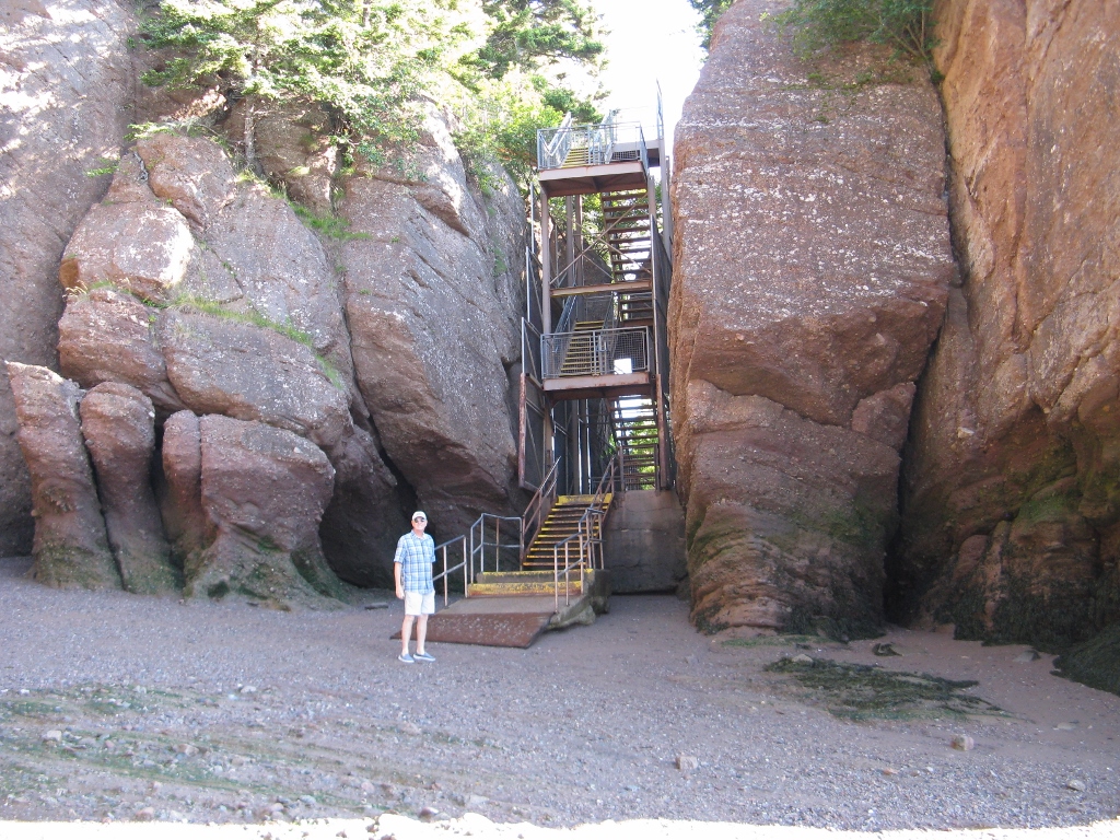
From the sign below, you can see that the Low tide is around 12:15 pm. We were there at 9:15 am which is 3 hours before low and the signs says to be back here by 3:15 pm which is 3 hours after low tide.

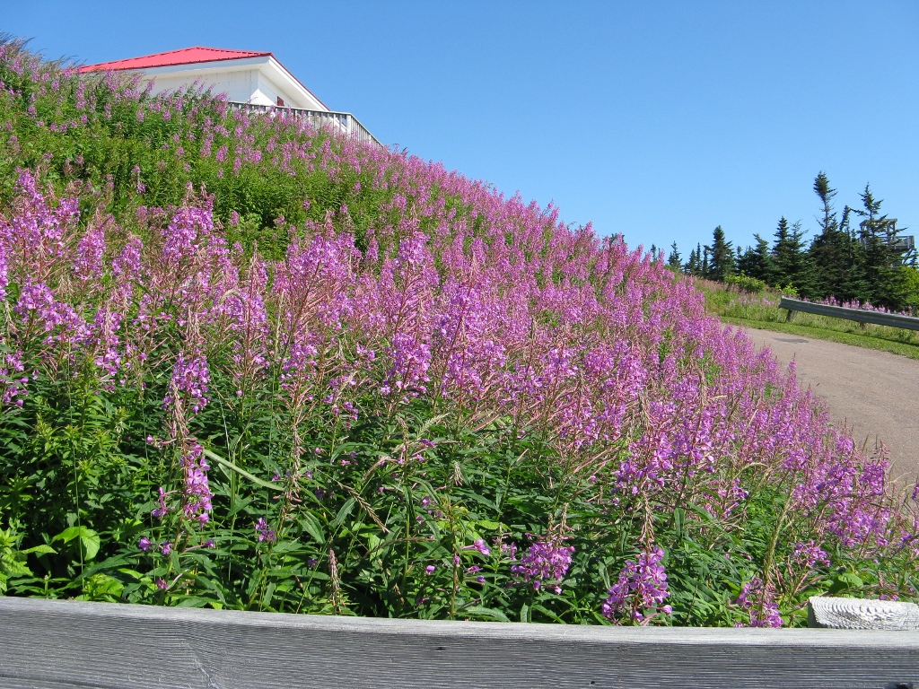
We did the "Fundy Bay Drive" along the coast to the Cape Enraged Lighthouse and to a small lobster town called Alma. Saw this beautiful Lupine growing everywhere.
Cape Enraged Lighthouse.

You can't tell it in the pictures, but the wind was blowing about 40 knots up here!

Really pretty scenery!

There was even a zip line you could take from one side to the other......maybe next time.

These boat are sitting on the ground in the small town of Alma as we drove past some of the docks.

The tide was going out.

While walking around town, we stopped in one of the many lobster houses. You could buy live lobsters or cooked lobsters.

The tank in above picture had live lobsters in it. You could pick out your lobster and they would cook it for you. Even had a few tables where you could sit and eat them.
...........or you could pick out one that was already cooked and take it with you.

While we were in town, Alan tried a Canadian dish called Poutine. It's made with french-fries and cheese curd topped with a light brown gravy type sauce. It's usually sold in small diner and pubs as well as by roadside chip wagons. Alan said it was different, but good.
We kept seeing these "moose" signs along the roadsides, however, we haven't seen a moose yet.

Finally saw a moose. He was in front of a gift shop.......he knew the place to be. Hopefully we will see a real one later.

Yep.....just a statue! But he looked real from a distance.
I'm guessing a lobsterman lives here.......

We passed this covered bridge on our drive back to the campground. There are several old covered bridges in the New Brunswick area.

........as well as this old barn.

Had fun at Hopewell Rocks and surrounding area. On our way into Nova Scotia to see tidal bore associated with the Bay of Fundy.
Great pictures Sandra!
ReplyDeleteGreat photos. Looks like you guys are having a great time.
ReplyDelete